Web Soil Survey (https://websoilsurvey.sc.egov.usda.gov/App/HomePage) Is a useful tool for studying many features of an area. There is a Youtube Video that helps go over some of the features and gives guidance. It is not a simple or intuitive web site, but after trying out some features you can start to see the potential. There are GIS features that can be exported if the user has access to ESRI or a similar GIS type software system. https://www.youtube.com/watch?time_continue=18&v=vszIhcghykk&feature=emb_title
Hopewell Big Woods covers two counties in PA. Since I knew my study area is not easily searchable I manually entered my Area of Interest (AOI) and made it as close as I could to the general boundaries of Hopewell Big Woods ((HBW). The eastern edge did not fit, but I felt I had a large segment to work with.
Fig 1 Hopewell Big Woods Map
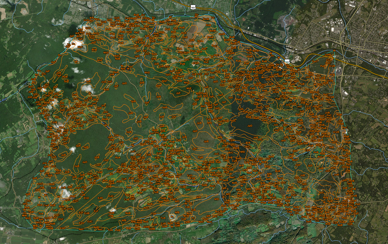
Fig 2 my AOI of Hopewell Big Woods
After I had my AOI set I clicked on the tab for the soil map and I got an expected error. I knew that I was going to be looking at different survey areas.

My next step was to look at soil health. This area contained several historic furnaces and mining locations. There are also places that have been developed. I know there are areas with slope, wetlands, rocky soil, and areas with visible scars from old charcoal pits. I wanted to look at soil types and then also organic matter depletion. After that I choose to look at conservation for trees and shrubs. The AOI is separated by county and then soil type and finally by categories by the user.

I think Web Soil has some great features for natural resource organizations. Using this tool can help determine the best soil type for plantings. It can show where there are areas of concern where organic matter has been depleted and my need to be supplemented. It also tells how many acres of a particular soil type is in the AOI and what percentage it makes up of the total. This information can be used for meetings with stakeholders. City planners could also use this in planning disaster recovery, looking at land classifications of an area and also in determining what recreational or sanitation facilities might be nearby. It is a complex tool, but that also broadens just how many organizations could use it.


No comments:
Post a Comment